GPTA on Podcasts – Episode 3

On the GPT in South Dakota

Here is another one from the podcast series, Mighty Blue on the Appalachian Trail by Steve Adams. This is episode #220 where he interviews Luke “Strider” Jordan about the North Country Trail and the Great Plains Trail. Enjoy!

https://mightyblueontheat.com/episode-220-luke-jordan-strider/


Posted in Uncategorized | Tagged , , , , | Leave a comment

GPTA on Podcasts – Episode 2

Strider on the GPT in New Mexico.

The next two podcasts will feature Strider. This first one is from Hiking Thru Life. He will be talking a lot about the North Country Trail, but also quite a bit about the Great Plains Trail. There are some really good insights here as to what a thru hike really is, and how to best prepare for one: Here is the link to Hiking Thru Life Podcast – You may need to scroll down to find Episode #37: “Strider’s NCT Thru Hike and Beyond

Podcast


Posted in Uncategorized | Tagged , , | Leave a comment

GPTA on Podcasts

Recently, the Great Plains Trail has been featured on a few podcasts. We’ll take the next few posts to connect you to those podcasts in case you haven’t heard them. If you’re still self isolating at home (I hope you’re able to get out at least a little bit), these are great to listen to. The first podcast is from Mighty Blue on the Appalachian Trail Episode #215 where Steve Adams (Mighty Blue) interviews Clay Bonnyman Evans about his Pilot Trail hike that August. The Interview with Clay starts at the 39:00 mark.

Here is the Link: https://mightyblueontheat.com/episode-215-paul-curtin-magnum/


Posted in Uncategorized | Tagged | Leave a comment

Backpacking in America as a Person of Color: Hikers Share Their Experiences – Clay Bonnyman Evans

Just a couple miles past the Mason-Dixon line during his Appalachian Trail thru-hike, Daniel White, aka The Blackalachian, and a female hiking partner decided to camp at Pen Mar Park.

Just after dark, a group of white men riding motorcycles and driving trucks began shining their lights on their tents and howling like wolves. Soon, more showed up, some with large dogs.

White, an African American hiker who grew up not far from the AT in Asheville, North Carolina, thought, “I see where this is going.” He and his white friend quickly broke camp and moved on.

“It was an eerie experience,” he says now.

It was also the kind of experience that most long-distance hikers would not encounter or even worry about. But growing up African American, White had always been taught to be attuned to potentially dangerous situations. Some people he knew frankly thought he was crazy for “going into the woods” for months at a time.

“After public lynching was made illegal, they would chase people with dogs and lynch them in the woods. You don’t go in the woods,” he says, “because you might not come back out.”

A common stereotype holds that few non-white Americans, particularly African Americans, participate in outdoor recreation. The reality is not quite so simple. For example, a recent survey by the Outdoor Industry Association of participation in outdoor activities by age and race found that:

  • Caucasians by age group ranged from 39 percent (over 45) to 66 percent (ages 6-12)
  • Asian/Pacific Islander: 38 percent and 62 percent, respectively
  • Hispanic: 35 percent and 56 percent
  • African American: 25 percent and 47 percent.

A 2012 study by the Outdoor Foundation found that 11 percent of outdoor-recreation participants are black. That’s 18 percent less than the 13.4 percent of the population they represent, but not insignificant.

elsye walker chardonnay gila river continental divide trail

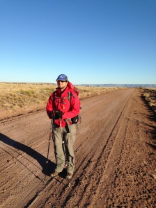
Elsye “Chardonnay” Walker, the first African American to achieve the Triple Crown, crossing the Gila River on the Continental Divide Trail in New Mexico. Courtesy Elsye Walker.

And a 2018 survey of 168 American university students (46 white, 43 black, 68 other races) published in Environmental Justice reported that, “None of the respondents say they are disconnected from nature. … The study found that black students prefer naturalistic landscapes more than urbanized settings and their perceptions of nature and landscapes mirror that of students of other racial and ethnic groups. None of the study respondents reported a generalized fear of nature either.”

Big Miles, Little Diversity

But when it comes to long-distance hiking, the stereotype hews much closer to reality.

Since 2016, The Trek’s annual survey of Appalachian Trail thru-hikers has included questions about race, finding that:

  • 94 to 96 percent of AT thru-hikers identified as white.
  • 2 percent self-reported as Hispanic or Latinx in 2019 and 2018, doubling the number from the previous two years.
  • Hikers identifying as Asian made up less than 1 percent in 2016, but grew to 1.4 percent in 2019.
  • Native American, Hawaiian, or other indigenous ethnicities have ranged from 0 to 1 percent, with a high of 0.8 percent.
  • Those identifying as multi-racial have ranged from 0.4 to 1 percent.
  • In three out of the four years, the survey picked up no hikers identifying as African American; the outlier is 2018, at just 0.3 percent. (That doesn’t mean they weren’t out there, only that their numbers were low enough that they were not captured by the survey sample.)

Anecdotally, hikers of all racial backgrounds confirm that non-white faces are few and far between on longer trails.

“Going into it, I knew I’d probably be in the minority,” says Amar “Bolt” Demeku-Ousman, 28, of Winnipeg, Canada, who hiked the AT in 2019. “I definitely wasn’t wrong. If I thought about it, I could probably count exactly how many people of color I saw.”

Amar Demeku-Ousman appalachian trail

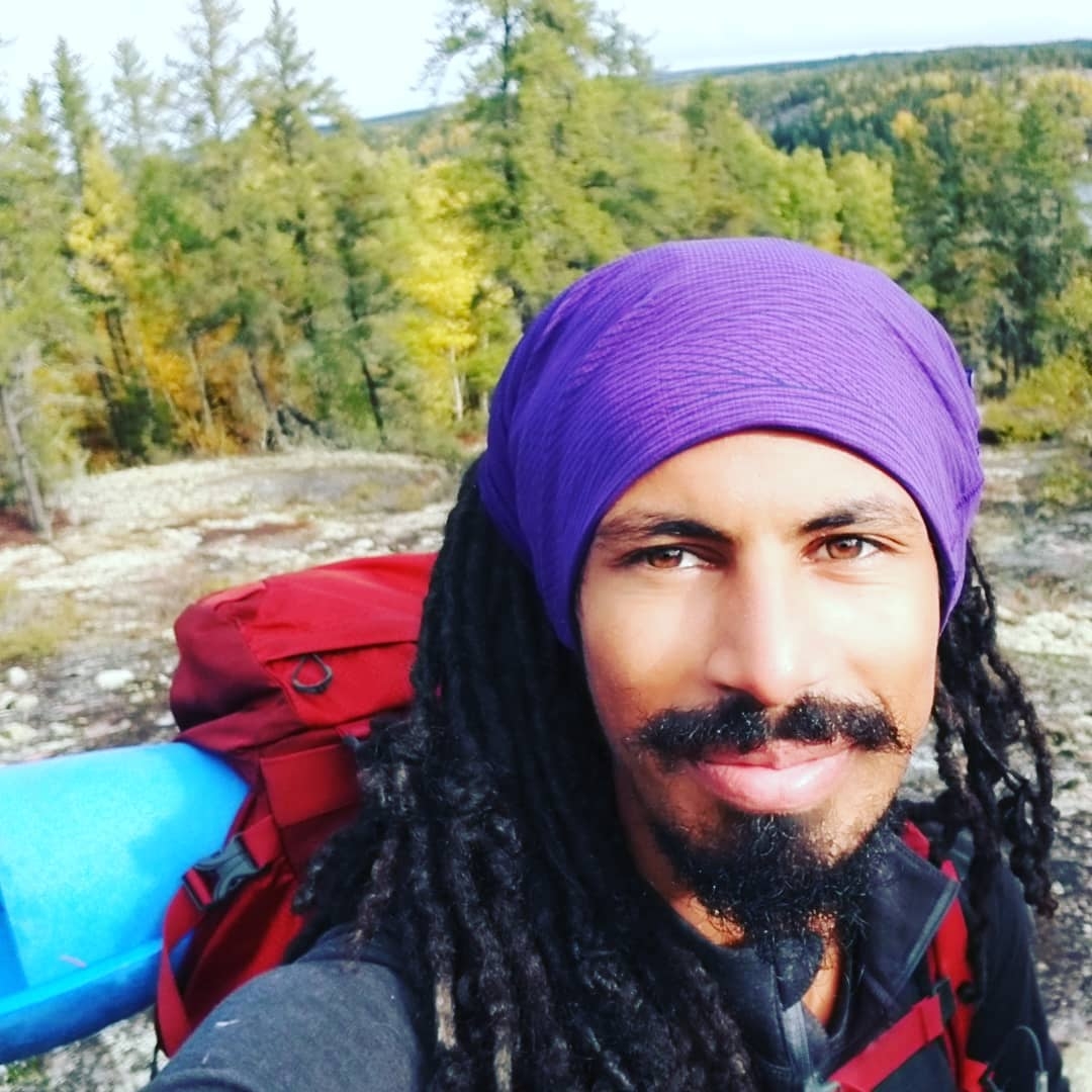
Amar Demeku-Ousman, aka Bolt, on the Appalachian Trail. Courtesy Amar Demeku-Ousman.

Given long-distance hiking’s reputation for dissolving differences on trail, some hikers question whether race should be considered differently than, say, economic background, education, or age. Many adopt a laissez faire approach, arguing that if people want to hike, they’ll hike, regardless of race.

People of color are out there, of course, including many who have become ambassadors for long-distance hiking. The Blackalachian is a hugely popular YouTuber; Will “Akuna” Robinson—the first African American male to hike the Triple Crown—has appeared in many videos for his sponsors; Rahawa Haile, aka Tsehay, has written for Outside Magazine; in 2009 Rue Mapp founded Outdoor Afro to organize outdoor activities for African Americans.

Open Arms

Rahawa "Tsehay" Haile, at McAfee Knob on the Appalachian Trail.

Rahawa “Tsehay” Haile, at McAfee Knob on the Appalachian Trail. Rahawa Haile photo.

The Trek recently spoke with several hikers of color about their experiences and diversity on trail.

Unsurprisingly, stories varied from hiker to hiker, with most reporting at least some uncomfortable moments on their hike. But all agreed that overall, their experiences with the hiking community itself—fellow travelers, trail angels, hostel owners and the like—were overwhelmingly positive.

“One of the most common sentiments one hears about the Appalachian Trail is how it restores a person’s faith in humanity,” Haile wrote in a 2017 piece for Outside. “It is no understatement to say that the friends I made, and the experiences I had with strangers who, at times, literally gave me the shirt off their back, saved my life. I owe a great debt to the through-hiking community that welcomed me with open arms, that showed me what I could be and helped me when I faltered.”

“Considering the general narrative right now, you would think it was a non-welcoming hobby. But for me, I’ve always had the opposite experience. I went out and had a great time and had no problems with anybody, racial or otherwise,” says Elsye Walker, aka Chardonnay, 49, the first African American to complete the Triple Crown.

“I don’t think I was treated any differently by a lot of people,” says Esperanza “Where’s My” Garcia, 36, who completed a flip-flop thru-hike of the AT with her husband in 2019. “Once you are out there, nothing matters, religion, politics, race. No one really cares.”

Town Frowns

esperanza garcia appalachian trail

Esperanza “Where’s My” Garcia on the Appalachian Trail. Courtesy Esperanza Garcia.

A second point of broad agreement: Uncomfortable situations most often occurred in town or, if on trail, with non-thru-hikers.

“My anxiety didn’t come from people on trail,” Demeku-Ousman says. “Except for one person, who I think must have had some mental issues, it was going into towns. … Grocery stores and restaurants were not necessarily used to seeing a random black guy with dreadlocks.”

In Massachusetts, he and his trail family stopped at a grocery store to resupply. While his white companions, a British man and a woman from the Netherlands, had no trouble signing up for a card to receive discounts, he was denied that privilege by a clerk. After some 20 minutes, a reluctant manager eventually granted him the discount.

“When I asked my tramily member if he wanted to use my card, he was like, ‘No, it’s fine, she gave me the pricing.’ He pointed to the same clerk who denied me,” Demeku-Ousman recalls.

White recalls an incident after he passed through Franklin, North Carolina, where another black hiker had been accused of stealing from a local hostel.

daniel white blackalachian

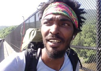
Daniel White, aka The Blackalachian. Courtesy Daniel White.

“Next thing I know, my picture ended up on a Facebook page, like I was the one who stole from the hostel,” White says. “I didn’t even know the other guy, and I had only stopped by for maybe five minutes, to pick up a package.”

In Klamath, Oregon, Robinson asked a man mowing his lawn about hotels in town. The man snapped, “We don’t have marijuana for you people here.”

“That’s not even close to what I was asking you,” he remembers thinking. “He just automatically assumed that a black man with dreadlocks was looking for weed.”

And, counter to widely held cultural assumptions, many hikers of color have found that they experienced more hospitality and less hostility in the South than in the Atlantic region, New England, or Pacific Northwest.

“Coming from Canada, I definitely had anxiety and preconceived notions about the South,” Demeku-Ousman says. “Other than a few looks, people treated me with hospitality in the South that I didn’t find anywhere else on the trail. … The more north I went, the more issues I had. It was completely opposite of what I’d expected.”

Assumptions and Insults

will robinson akuna continental divide trail

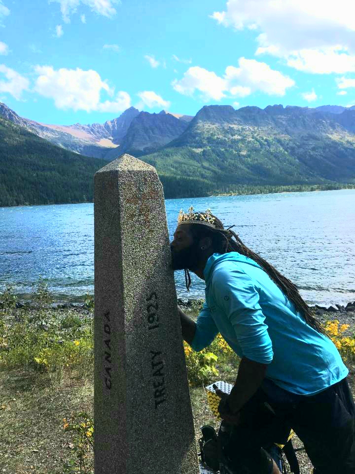
Will “Akuna” Robinson, the first African American male to complete the Triple Crown, at the Northern Terminus of the Continental Divide Trail. Courtesy Will Robinson.

While nobody said they felt actively threatened, some ran into people who made assumptions—sometimes overt, sometimes bizarre, sometimes merely clueless—because of their race.

Robinson was in Massachusetts when he approached an older white day hiker from behind. He let the man know he was coming up, whereupon the man barked, “What? Is football and basketball not enough for you people anymore?” and refused to make way for him to pass.

With a trailhead approaching, Robinson backed off. But the man continued to chatter, expounding on his belief that African Americans don’t belong in the backcountry, as they were more likely to require search-and-rescue or “burn down the woods.” But at the trailhead, the man recognized Robinson.

“Hey, I think my wife and daughter follow you on Instagram,” he asked. “Can I take a photo with you?”

“I told him in the politest way possible,” Robinson says, “to fuck off.”

In Georgia, the PCT veteran received a stream of unsolicited advice from a neophyte hiker. Only later did the hiker recognize, with considerable embarrassment, Robinson from his popular Akuna Hikes Instagram, and sheepishly apologize for his condescension.
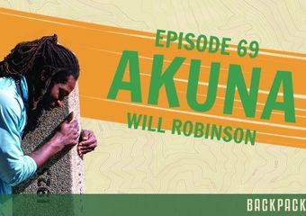
“Some people see a black figure on trail and they automatically assume you have no clue what you are doing,” Robinson says.

Some familiar signals of prejudice are subtle.

Karl “Papa Bear” Banks, 37, a section hiker who aspires to thru-hike the AT when he retires, was hiking toward Black Rock Hut in Shenandoah National Park when he approached three white women from behind. When he realized he was making them nervous, he backed off.

karl papa bear banks appalachian trail

Karl “Papa Bear” Banks on the Appalachian Trail. Courtesy Karl Banks.

“My parents always made me aware that when you get those type of looks, leave the area or stay low-key. Don’t give anyone a reason to suspect you,” he says.

Only later at the shelter, after the women overheard him talking with other hikers about his military experience and speaking with his young son on Facetime, did they let down their guard and begin talking to him.

In response to such incidents, many hikers have developed thick skins.

“Did I see Confederate flags and Trump signs? Sure,” Walker says. “But to me those are just things; they can’t hurt me. I just let those things come in and go out of my life.”

“There is way more good on the trail than there is bad. I’m not going to let one bad apple ruin such an amazing experience for me,” Demeku-Ousman says.

Broadening the Appeal

Eyeing a demographic future in which non-white people will become a majority in the United States, organizations such as the Appalachian Trail Conservancy have set goals to increase racial diversity on trail.

appalachian trail conservancy summit seekers

Brittany Leavitt of Outdoor Afro, and an ATC Next Generation Advisory Council member, with fellow ATC Next Generation Advisory Council members Tony Richardson and Kristin Murphy at an ATC Summit Seekers event. Photo by McKenzie Grant-Gordon/ATC. Photo by McKenzie Grant-Gordon

One pillar of the ATC’s vision is to “engage and connect to a younger and more inclusive audience, broaden the understanding of the physical and mental benefits provided by the Trail, and cultivate the next generation to value and steward the Trail. As a mostly white, older organization this is a challenging goal.”

Challenging, but worthy, many hikers say.

“I definitely think it’s important to get more people of color out there, to increase the population who will protect natural resources and stand up for public land,” Robinson says. “If we want to have natural lands for the next generation, we need that diversity.”

Walker agrees, but hopes that the current lack of diversity won’t keep anyone from hiking.

“Getting more people interested in protecting our public lands is a good thing,” she says. “However, I believe it’s more important to encourage people of color to find and follow their passion. There will be challenges, racially or otherwise. Don’t let fear, demographics, or finances keep you from a transformative experience.”

There are many reasons people of color may not have embraced thru-hiking in numbers proportional to their populations.

“I’m often asked why are there few people of color hiking the trail,” says Derick “Mr. Fabulous” Lugo, author of the recent memoir, The Unlikely Thru-Hiker. “I can’t answer for the entire community, but I can give you reasons I have seen and experienced: financial, lack of knowledge, and lore.”

derick lugo unlikely thru-hiker katahdin

Derick Lugo, aka Mr. Fabulous, author of The Unlikely Thru-Hiker, at the summit of Katahdin. Courtesy Derick Lugo.

When it comes to lore, many African Americans, in particular, may have been taught by their families that going “out in the woods” is dangerous, based on brutal history.

“The way I was brought up, it was, don’t go into the woods because you could get lynched. Behind the house in Maryland where I grew up, my mother was always very adamant about me not going into the woods,” Banks says.

And yet, he notes, his grandmother was skilled at woodcraft, hunting, and fishing, and that prior to the “Great Migration” of 1916-70, in which some 6 million black people migrated from the rural South to cities in the North, Midwest, and West, most were deeply in tune with outdoor environments.

“We really are country bumpkins,” Banks says. “It wasn’t until we moved to the city that we abandoned our outdoor roots.”

Gearing up for a 2,000-mile hike can also be expensive.

“Especially for something like a thru-hike, it costs a lot. Even though you are living in the woods, that shit costs money,” Garcia says. “We spent a lot more we thought we would.”

Getting the Word Out

Many hikers of color come to long-distance hiking the way a lot of people do, through books, movies, or YouTube videos. Still, many aren’t aware that such a thing even exists.

“What is most disheartening is that within the black community is that our lack of education, culture, and history by default exempts us from experiencing the outdoors,” Banks says. “Hell, I’ve had people in my race look at me as a pink elephant with white polka dots, wearing a tutu and walking on a high wire. Several have told me that I was crazy for being in the woods.”

Organizations are seeking to change that through education and outreach. The ATC’s “MyATStory” video series, for example, documented a group of inner-city students who hiked every mile of the AT in their home state of New Jersey as part of their graduation plan.

Appalachian Trail Conservancy.

“The efforts to increase diversity are trending in the right direction,” Robinson says. “From 2016 to this year, there are way more people of color. It’s still not a big percentage, but it’s more every year. And the more exposure there is, the more likely people of color are to see it and become interested.”

And, as Lugo writes in his memoir, “Diversity has not yet reached the AT, although the trail does seem ready, wide-eyed and with open arms.”

Posted in Uncategorized | Tagged , , , | Leave a comment

Some Reflections on a Great Adventure

Pony, Emily and Josh – Photo: Clay Bonnyman Evans

On Sunday, I posted the final episode of Clay’s (Pony’s) journey in 2019 on the GPT Pilot Trail. I decided from Episode One that I would read each episode as I posted them, and not binge on them. It turned out that was a great way to do it. Long journeys deserve long write-ups and long reads. We use Cliff Notes on the boring, esoteric stuff, but a gripping tale of earthly hardship and triumph is when we want the full account. My hat’s off to Pony for a wonderful series of posts and pictures that I believe capture the spirit of the GPT perfectly.

As with Luke (Strider) Jordan’s trip on the GPT in 2016, these two adventures represent exactly what I think the GPT can be – a new and different kind of adventure in a unique place that is so often overlooked or even scorned. In both cases, it turned out that even though the Great Plains is known for huge lonely spaces (and each trip definitely had its share of extreme solitude), it was the connection to people along the way that made the adventures memorable and ultimately worth it.

In Strider’s case, I think of all of the timely trail magic he encountered just as things were looking grim, as well as the unexpected enthusiasm and encouragement he received from complete strangers. On Pony’s trip, I think of his days with Emily and Josh, and the little bits of magic they found even amidst the heat and the bugs.

I began this entire project because I thought the landscape of the Great Plains was beautiful. It is, but in the picture above, which shows only the landscape of their smiling faces, I see a reflection of the true beauty and potential of the Great Plains Trail!


Posted in Uncategorized | Tagged , , , , | 1 Comment

GPT Pilot Trail – Episode 18 (Final Episode)

Sadly, this is the eighteenth and final episode. It’s been a great read from a great adventure on the Great Plains! Thanks Clay!

Great Plains Trail Pilot Trail: Episode 18

Day Eighteen: End of the Trail

  • September 5-6: Lake Minatare to Scottsbluff National Monument; Scottsbluff
  • Miles: 21.5 (including walk back into town)
  • Elevation gain: 200 feet

I woke early and headed off around the western end of Lake Minatare, seeking to avoid the roadwalk advised by the databook. For once, a shortcut turned out OK, and I was happy to have walked through the woods — where piles signs of the spring’s flooding were still evident — rather than on pavement. The day ahead was going to have plenty of pavement as it was.

lake minatare clay bonnyman
Lake Minatare, Nebraska. Clay Bonnyman Evans photo.

Ugh. 10 miles of roadwalking at least, tomorrow, I wrote in my journal the night before.

Once out of the cottonwoods, I bushwhacked through a short stretch of long grass to Lake Minatare Road, which the databook indicated I should follow for six miles. There wasn’t much of a shoulder, but it was just after 6 a.m., so there wasn’t much traffic, either. But after a couple of miles, the morning commuters had begun to whiz by.

When I came to dirt County Road 27 I wondered if it might not offer an alternate route. Most rural agricultural counties are laid out in grids, so it seemed possible that I could follow the dirt road south until reaching an east-west farm road, and make my way into town that way. The map function on my phone confirmed that I could, with the slight caveat that I would be adding about a mile of distance where a county road skirted around the regional airport.

scottsbluff clay bonnyman
Shadow companion near Scottsbluff, Nebraska. Clay Bonnyman Evans photo.

It turned out to be a good choice. With no wind blowing, walking on dirt made my battered feet slightly happier than asphalt and I was dusted by just handful of trucks. The landscapes were pleasantly open, if unexceptional, and I found myself feeling grateful that I had bailed on 40 miles of this from Alliance to Lake Minatare.

By 10 a.m. I was sauntering down 27th Street toward the Capri Motel on the west side of Scottsbluff. It was a dive, but also relatively inexpensive. I dumped my pack on the bed, sorely tempted to quit, but decided to stick to my plan to slack-pack — hike without gear and hitch back to the motel — through town to Scottsbluff National Monument, the “official” end of the pilot trail.

I downed a quart of Gatorade, filled a water bottle, put on my sandals and headed out. It was only about six miles to the monument, then less than a mile to the top. I felt surprisingly fresh as I crossed the North Platte River and skirted along the west side of the bluff to reach the visitor’s center right at 1 p.m. The views on top were great, but suddenly ravenous, I didn’t linger.

Fortunately, I didn’t wait long at the bottom before a guy in a pickup said I could ride in back. He dropped me off just across the bridge, which meant my hunger had to put up with another two miles of streetwalking back to the hotel, where I gathered my reeking clothes. I tossed my Altra Timps, which had blown out at the sides after more than 500 miles and walked to the laundromat.

Scottsbluff National Monument. I forgot to take any photos. visitnebraska.org.

I devoured three bean burritos at Taco Bell and once more indulged the thoroughly out-of-character craving that had dogged me for nearly 300 miles, a big, icy Pepsi (I’m a Coke man, but in a pinch….)

Ready to eat again a couple hours later, I was disappointed to find that the authentic-looking Mexican place near the motel was closed due to a family emergency. I was deeply underwhelmed by the fare at the other “Mexican” place up the street, staffed by surly teens and featuring a lily-white Nebraskan idea of what Mexican food should be. The “hot sauce” resembled watered-down ketchup and the margarita tasted (no, really) like a feedlot.

~~

The ride home took about three hours, including stops in Cheyenne and Fort Collins. The cranky woman driving slightly warmed up to me when she heard me singing quietly along to the America tunes she was playing, which she then turned up way too loud.

Waiting for Jody to pick me up at the McDonald’s just off I-25 east of Longmont I talked to a guy who had a backpack, cooler and other gear strapped to a set of wheels. He said he’d been on the road for 17 years and was headed back to Minnesota to spend time with his family.

And then, quite suddenly, I was back in the “synthetic world,” as famous thru-hiker Dixie calls it, burned, scabby, sore and 10 pounds lighter.

“Well,” I said, quoting Samwise Gamgee from “The Lord of the Rings” (as I always do upon coming home after a hike), “I’m back.”

clay bonnyman evans
Back home with dear Liesl, 18, who would die a week later. Jody Evans photo.

~~

I wanted to hike the pilot trail to do my small part in continuing to educate the public about the Great Plains Trail and its potential. In late October, I was thrilled to listen to the stories Emily had created from our three days together on KIOS and, a month later, see Josh’s video interpretation of the experience. So, mission accomplished; thanks, you guys.

I also wanted to see for myself whether a self-supported hike of pilot trail is viable. Although I bailed out on two extremely long days into and out of Alliance, I think the route is viable — but only for experienced hikers capable of racking up 30 or 40 miles.

The limiting factor is the distance between public land, private campgrounds or motels where hikers can spend the night in Nebraska. My three long, hot days (four, if you count the 23-mile day into Edgemont, S.D.) across the “savannah” were certainly challenging, but would have been less intense without the late-summer heat.

Once in the Ogalala National Grasslands, there were plenty of stock tanks and ponds and a couple of creeks along the route (likely not the case in a dry year). And a careful researcher probably could determine the exact locations of public lands on the public/private checkerboard of the grasslands, potentially opening up new possibilities for camping sites to break up some long days.

In my opinion, the biggest challenge of the pilot trail is the roughly 120 miles of highway and dirt-road walking from Nebraska National Forest to Scottsbluff. It’s hard to know how to break that up, other than to suggest that, as on parts of the GPT in New Mexico and Colorado, hikers have vehicle support. On a bike, the pilot trail is eminently doable.

Posted in Uncategorized | Tagged , , | Leave a comment

GPT Pilot Trail – Episode 17

The seventeenth in a series from Clay Bonnyman Evans on his thru hike of the GPT Pilot Trail in August of 2019. I will be doling out the episodes here, but if you absolutely can’t wait to read on, you can at his website: https://claybonnymanevans.com/great-plains-trail-pilot-trail-episode-17/

Great Plains Trail Pilot Trail: Episode 17

Day Seventeen: Alone Again

  • September 4: Pine Ridge Trail to Hough Road (walking); Lake Minatare (yellow-blazing)
  • Miles: 6
  • Elevation gain: 500 feet

The wind was still insistent when I gave up on sleeping and started organizing my gear at around 4:30. Emily was rustling around in her tent, too. I donned a long-sleeve Merino wool shirt and my on-its-last-legs Frogg Toggs rain coat — at $25, still the best rain protection I’ve ever had — to keep warm as I fought the wind for possession of my tent.

The Pine Ridge Trail remained fickle as we set out just after 6 a.m. At the windmill, I could not see the next post, and the foliage leading southeast was thick, tangled and completely untrodden, so far as I could tell. So, we marched off, high-stepping on a course skirting the edge of the next shallow canyon, hoping to pick up the trail before it dropped into East Ash Creek Canyon.

In character, the PRT presented various difficulties, especially a lack of tread, leading to a goodly half-mile of ‘weed whacking,’ I wrote later. I could tell E wasn’t having much fun, and I don’t blame her. The uneven ground is hidden and must have been hell to walk on with that blister and her sore ankle.

clay bonnyman evans emily chen-newton
A good-hair day on the Great Plains Trail. Emily Chen-Newton photo.

After a bit, we did spy a distant post, which we followed to the next and the next, around the southern tip of the canyon, then down into the East Ash Creek drainage. As we descended, the tread became clear and the windblown, burnt-matchstick terrain gradually became more lush and protected from the wind. On the downside, there were intermittent patches of poison ivy.

We found the creek running with clear water and filled our bottles. When we reached the road, the east-side doppelganger of West Ash Canyon, we had a decision to make.

The databook suggested following Pine Ridge Trail a couple miles east before following a Forest Service track to Highland Cemetery, and following busy, dusty, no-shoulder Table Center Road for six miles. Tom had urged us not to walk on Table Center Road, and I agreed, having driven it on my way to Rapid City and decided it would be dusty and potentially dangerous. He suggested we follow East Ash Creek Road up to the top of Pine Ridge, then go south on less-traveled dirt roads. It would add several miles to the next available campsite, at Box Butte Reservoir, but it would be safer and more pleasant.

I chose Tom’s option, as much as anything to see if it was a viable alternative. After what felt like a long hike up on the road to the top of the ridge with a finicky, sometimes stiff breeze swirling around us, Emily and I popped out of the woods onto Table Road. Now unimpeded by trees, the wind flailed away at us as we marched east, then turned south on Hough Road. My eyes were soon full of dust and grit and I could sense Emily slowing down.

Not far down the road, I stopped and asked what she wanted to do. Having hiked more than 30 miles over two days and change, much of it in pain, she was ready to wrap it up. She called Josh and we hunkered down in the long grass at the side of the road, trying to hide from the wind.

emily chen-newton clay bonnyman evans nebraska
Emily dodges the wind on Hough Road, Nebraska. Clay Bonnyman Evans photo.

Now I faced a decision. Beyond Box Butte lay what I expected would be the least pleasant two- or three-day stretch on the pilot trail, 38 miles of roadwalking to Alliance, either done in one mind-numbing jag, or broken into a 10-mile jaunt into Hemingford followed by a 30-mile day to Alliance. From Alliance, the databook called for another foot-killing day, 40 miles on dirt farm roads to Lake Minatare.

While I would have been proud to say I’d done it (even Luke “Skywalker” Jordan, the only person ever to have walked the complete GPT, from Texas to North Dakota, hadn’t; the route had been different when he hiked in 2015), I certainly didn’t need to. Meanwhile, Josh and Emily had agreed to give me a ride to Alliance or Lake Minatare if I wanted.

I kicked the can down the road for the moment, deciding to yellow-blaze to Box Butte, cutting this day short by a whopping 20 miles. I’d still be able to scout Tom’s route — which, I was realizing, was a pretty long haul — then decide whether to camp and walk to Alliance.

If not for that miserable wind and dust, I might have said goodbye right there, but in the end, I was glad I didn’t. We drove Tom’s route — a 25-mile day from the East Ash Trailhead; certainly doable, less crazy traffic, but still plenty of dust and an additional 8 miles of walking — and then had a blast swimming in the wind-whipped green waters of the reservoir, a fitting end to Josh and Emily’s journey. I just couldn’t face all that roadwalking, so they kindly agreed to drive me an hour out of their way to Lake Minatare, where I’d camp before walking into Scottsbluff.

box butte reservoir clay bonnyman
Pony, Josh Labure and Emily Chen-Newton after swimming on a very windy day at Box Butte Reservoir, Nebraska. Clay Bonnyman Evans photo.

This meant cutting my walk short by two or three days. But I’d had an incredible, challenging adventure through the Black Hills and across the savannah, and it didn’t seem likely that 80 miles of asphalt and dust through farm country would improve the experience all that much. I called the Scottsbluff-Denver International Airport shuttle and made arrangements to be dropped off east of Longmont on I-25 two days hence.

Going home at 6:45 Friday morning. One more day of walking, I wrote that night.

And so, after a celebratory beer at Lake Minatare, I hugged Emily and Josh and watched them drive away for their eight-hour drive to Omaha.

I am now used to the exhilaration of trail relationships catching fire and burning fiercely within days, sometimes even hours or minutes. And yet, the sweet melancholy of separation that follows never stops feeling brand new.

I spent the rest of that hot, breezy afternoon swimming in a deep cove and exploring the nearby woods, where I spooked several whitetail deer. I fell asleep that night to the croaking of countless frogs and insects keening in cottonwood branches high above.

Posted in Uncategorized | Tagged , , | Leave a comment

GPT Pilot Trail – Episode 16

The sixteenth in a series from Clay Bonnyman Evans on his thru hike of the GPT Pilot Trail in August of 2019. I will be doling out the episodes here, but if you absolutely can’t wait to read on, you can at his website: https://claybonnymanevans.com/great-plains-trail-pilot-trail-episode-16/

Great Plains Trail Pilot Trail: Episode 16

Day Sixteen: Pine Ridge

  • September 3: Crawford to campsite on Pine Ridge Trail
  • Miles: 12
  • Elevation gain: 1,500 feet

I woke at 4:30 a.m., just before the birds, as I often do on trail. Ten minutes later, I heard Emily emerge from her tent and begin making coffee.

She’s an old climber girl, I noted in my journal. Knows this kind of life.

We were heading out of Crawford and into the Nebraska National Forest. Rather than force Emily to walk endless miles just to be complete, we had Josh drop us off three miles east of town on dirt West Ash Creek Road. Just after we got out of the car at 6:20, a bloated and bloody sun swelled over the eastern horizon, looking deliciously apocalyptic.

sunrise crawford nebraska bonnyman
Sunrise, east of Crawford, Nebraska. Clay Bonnyman Evans photo.

The gravel road rolled up and down for a few miles, running perfectly straight toward that sun, which quickly shrank and faded from red to hot white. To the south, sculpted buttes capped the low, sparsely forested hills of Pine Ridge. Several miles in, I made a foolish error, once again failing to look at a map and taking us on a wrong turn that cost us a mile of extra walking.

We turned south to follow West Ash Canyon into the hills and after a couple of miles stopped at a fenced spring flowing with clean, cold water. Emily had a blister, a mean monster between two toes on her left foot. It looked painful, but she didn’t complain and just kept walking, like a true thru-hiker.

During our rolling conversation, she’d told me about the connective-tissue disorder she’d developed about five years earlier. The illness had not just interfered with her once vigorously physical life, but also affected her confidence. That will happen, I guess, when you can dislocate a shoulder simply by swimming.

crawford nebraska cows clay bonnyman
Curious heifers, West Ash Creek Road, Crawford, Nebraska. Clay Bonnyman Evans photo.

I knew she was in pain, but she later told me that the thru-hiker ethic — just keep putting one foot in front of the other — and walking with weight felt like a way to both build strength and confidence to become the active person she’d once been.

Not too long after our break at the spring, we approached a small Forest Service picnic area just before the West Ash Trailhead of the Pine Ridge Trail, which we planned to follow east. I suggested we stop for a break and when we turned the corner, we were genuinely shocked to see Josh’s gray car, wearing a coat of white dust. He was napping in the front seat.

Truly unexpected magic, the best kind — Josh @ picnic area! I enthused in my journal that evening. Chips, salsa, Gatorade, fruit. So outstanding. He’s our angel!

We lounged there beneath the nickering cottonwoods for awhile, eating, drinking and laughing.

Man, I could really get used to this leisurely hiking style, I thought.

Then Emily made a suggestion: I’d told her about Tom and Carol Foster, whom I’d met at the museum in Crawford, and she wondered if I’d be willing to take a little detour to see their place. She wanted to get an interview with some locals. And why not? We had Josh, our angel/sagwagon, and the Schoolhouse B&B was less than a mile away.

We found the place using what I remembered from Carol’s laconic, country-style directions, “Just keep going down the road until you see the big red barn.” She was out, but Tom invited us to chat on the porch. Guinea fowl and chickens pecked around the yard while a series of cats and dogs wandered by for a sniff or pet. Carol soon got home and brought everyone iced tea. Emily recorded Tom talking about the land, the idea of a long trail coming through, and more.

Cool idea. Nice place. Could be a trail stop, I wrote.

After touring the barn and old schoolhouse, where guests stayed, and after saying goodbye drove back down the canyon to the trailhead. There were two stock tanks there, one choked with algae, but thanks to Josh, there was no need to water up.

It wasn’t as hot as the day before, but still plenty warm as Emily and I climbed from the canyon up to the broad, grassy plateau whose trees had nearly all been torched in the 2012 West Ash Fire. Up top, I was surprised how difficult it could be to follow the Pine Ridge Trail, which was prominently marked on Forest Service maps but obviously seldom used. Brown posts marking the trail seemed to disappear just when we needed them most, and frequently there was no tread at all through the tough, tall grass.

pine ridge trail nebraska clay bonnyman
Emily on the Pine Ridge Trail, area burned in 2012 wildfire. Clay Bonnyman Evans photo.

Emily and I saw a few deer and antelope bounding away from us and kept our spirits up through continued conversation and even singing to one another through an increasingly insistent breeze. She regaled me with John Prine’s “Angel from Montgomery” and I returned fire with Michael Burton’s old-timey “Night Rider’s Lament.”

At one point, as the trail began to descend into a dry canyon, we could see no brown posts. Instead of going all the way down to find we were on the wrong path, I dumped my pack, took off my shirt and ran back up the hill to the last post, then searched along the canyon rim, north and south. But I found no sign of the trail.

This was irritating as hell. I tried to call Steve, but he didn’t answer. Then I realized I had Tom Parker’s number, and he’d told us he knew the area by heart. Tom answered, and when I described the small house and windmill nearby, he knew exactly where I was.

“Go down into the canyon, but before you get to the bottom, look to your right and you’ll see the Forest Service posts heading south,” he said.

I jogged back to Emily, who was waiting patiently in the shade of her sun umbrella.

“When I saw your butt sweat as you ran off, I thought, ‘Oh that poor man!’” she said, having imagined a brutal case of chafe beneath my sodden, salty shorts.

I laughed because I could: Amazingly, I did not have any chafing.

“Yeah,” I said sheepishly. “I’m a sweater!”

Tom steered us right, and we might well have missed the southward turn if not for his directions. We followed the posts along the bottom of the shallow canyon, then into the mouth of a draw leading back up to the plateau. There, again, the markers were misleading, taking us up the flank of a steep hill before petering out.

“Look at that,” I said, pointing to a post in the bottom of the draw below. “Why send us up this hill if we’re only going back down? I would have stayed down there if not for these lying posts!”

We clambered down to the gulley bottom and followed it up to where it spilled out onto the plateau. It was 4:30 and the wind was now gusting to 15 or 20 miles an hour. We lost the trail again — no posts, no tread — but I’d looked at my sources and as best I could tell, we needed to skirt along the east rim of the canyon over rolling, grassy swales studded for a half mile to a windmill. But I could see that Emily was beat. It had been a long, bush-whacky afternoon even for me, and I didn’t have a blister the size of a grape between my toes.

“How about we find a spot to camp up here?” I said.

pine ridge camping clay bonnyman
Campsite, Pine Ridge Trail, Nebraska. Clay Bonnyman Evans photo.

We stomped along through the grass for maybe a quarter of a mile and pulled up in the shade of a lonesome ponderosa. We pitched our tents and I hung my soaked shorts and shirt on the skeletal branches of a burned tree nearby. After we’d rested a bit, we slogged through the grass to the windmill, which, alas, was not running.

Back at camp, we considered dinner. Emily had scored some high-end freeze-dried camp meals and we decided to cook and share a fancy egg thing. It did not turn out well, half-burned, half-crunchy and half stuck (yes, three halves, that’s how unsuccessful it was) to the bottom of my little titanium cook pot. But we ate some and laughed about our culinary un-prowess.

By the time the sun had disappeared in the west, the wind was picking up.

Night turned crazy windy. By 3 a.m.-ish a stiff, west wind was blowing 25 or 30 knots, working hard to press the Skytrekker flat, I wrote later. Slept only fitfully after that.

Posted in Uncategorized | Tagged , , | Leave a comment

GPT Pilot Trail – Episode 15

The fifteenth in a series from Clay Bonnyman Evans on his thru hike of the GPT Pilot Trail in August of 2019. I will be doling out the episodes here, but if you absolutely can’t wait to read on, you can at his website: https://claybonnymanevans.com/great-plains-trail-pilot-trail-episode-15/

Great Plains Trail Pilot Trail: Episode 15

Day Fifteen: Replay

  • September 2: Toadstool Geologic Park to Cottonwood Road
  • Miles: 12
  • Elevation gain: 1,000 feet

Three phone alarms went off at 5 a.m. the next morning and we rose in the dark, reminding me of the dim and distant days when I’d spent six years cowboying on ranches around the West. Jean had been the one to suggest we eat breakfast early, so we packed up and eagerly awaited the arrival of coffee and whatever edible delights she had prepared for us.

Outside, a strange, warm fog had descended over the land, dampening the fur of the herding collie puppies who barreled toward us from the ranch house. Jean and her son arrived with trays of great-smelling chow at 6:30. We ate quickly, loaded up, and headed north on Toadstool Road.

toadstool nebraska bonnyman
Forest Service sign I’d missed before. Clay Bonnyman Evans photo.

This was going to be a little redo for me, following the intended route. We crept along Orella Road in Josh’s car as the fog lifted into a low, gray ceiling and I peered out the window to find the Forest Service road that I’d missed before. The odometer indicated it was 2.7 miles from Toadstool Road; no wonder I’d been grumpy that afternoon….

With memories of my searing walk across the Great Nebraska Savannah, I was pleased that the temperature was lurking somewhere in the 60s and tiny droplets pricked my cheeks. It should make for pleasant walking.

Emily and I headed south on FS918 at 7:30. Josh tailed us for a short while, capturing video, before turning back to drive to Toadstool. Emily and I were, indeed, like trail family from the start, as we quizzed one another and slowly revealed our lives. She grew up in Kentucky and was a one-time “climber girl,” sleeping in her car and hanging with dirtbags for fun. She’d traveled extensively overseas, including a train-and-trail trek across the Australian Outback. And she’d been a performer, a singer, even a clown.

emily chen-newton great plains trail clay bonnyman evans
Emily Chen-Newton. Clay Bonnyman Evans photo.

In no time, we reached the GPT sign and turned east to walk to the campground. Once again, the mosquitoes were on the attack, so we spent little time there with Josh before heading out to jump on the Bison Trail south.

The southbound trail drew us into a steep-sided draw which, to my great surprise, was flowing with recent rainfall.

Bison Trail follows wash, which was muddy! A frog! Many toads! I wrote later.

The air remained pleasantly cool as we splashed along the slowly rising gulley, emerging on the rim of a grassy plateau and crossing FS918 after some three miles.

Emily is extraordinarily sensitive to poison ivy, and I knew we would be crossing a couple of gullies where the three-leafed menace might be growing. I’d already picked up the rash around my ankles somewhere along the trail and kept my eyes peeled as we made our way across the plateau.

We reached the Hudson-Meng site at mid-morning on Labor Day, the final day of the interpretive center’s season. There was no fee for the tour of the site, a rich “bonebed” where the remains of more than 600 prehistoric bison had been discovered (my friend Steve Cassells had helped to develop it in the early days). Evidently, subsurface imaging indicates that the bonebed extends far beyond the current site, a task for future archaeologists.

Pony, Toadstool Geologic Park. Those nifty blue poles are Emily’s. Emily Chen-Newton photo.

While we toured the site, the morning clouds burned away and I knew we were in for a hot afternoon. I changed into sandals and slugged down two free bottles of water.

Emily, who as a ginger is also sun-sensitive, busted out her shiny silver sun umbrella, donned a broad, floppy-brimmed hat and slathered herself with sunscreen. I bought a Six Moon Designs sun umbrella specifically for this walk, but in (yet another) dumb decision, had decided to leave it at home. Now I tucked a bandana beneath my cap and applied sunscreen and lip balm.

It was interesting walking the same lonely roads, this time with company. The miles rolled by swiftly, lubricated by our near-constant, and never-dull, conversation. We saw lots of cattle, including herds of curious steers, a few deer and several pronghorns.

great plains trail clay bonnyman emily chen-newton
Still-life with Emily and steers. Clay Bonnyman Evans photo.

But our moist, cool morning had turned into a blazing hot afternoon, with the temperature in the mid-90s when we met Josh on Cottonwood Road around 3 p.m. I was happy to “yellow blaze” — hitching a ride to skip miles, in hiker parlance — those long, hot, dusty roads into town, having already served that sentence, and Emily had already put in a good first day.

Per the plan I’d devised, we drove back to Crawford and pitched our tents for $10 each in the shade of tall trees in the city park. I called Jody and my mother, then the three of us sat around cooking and eating dinner and talking until after dark.

Posted in Uncategorized | Tagged , , | Leave a comment

GPT Pilot Trail – Episode 14

The fourteenth in a series from Clay Bonnyman Evans on his thru hike of the GPT Pilot Trail in August of 2019. I will be doling out the episodes here, but if you absolutely can’t wait to read on, you can at his website: https://claybonnymanevans.com/great-plains-trail-pilot-trail-episode-14/

Great Plains Trail Pilot Trail: Episode 14

Days Thirteen to Fourteen: Up with People!

  • August 30-September 1: Crawford, Nebraska
  • Miles: 8 (plus uncounted town miles)
  • Elevation gain: 1,000 feet (going up and down the hill to motel)

The next day, Saturday, Aug. 31, I had ambitions to walk the four miles from the motel to Fort Robinson State Park and back, but there was no way. My right ankle and lower shin were stiff and extremely sore from the exertions of walking some 100 miles in full summer heat over the previous four days. I’m not good at sitting still, but I forced myself to stay in bed until 8 a.m. before hobbling back down the hill. There was no place to eat breakfast, but I bought a decent cup of coffee, then walked a few blocks to the city park check out the “Rock Show” I’d seen signs for.

crawford nebraska clay bonnyman
Crawford, Nebraska. Clay Bonnyman Evans photo.

I chatted with several rockhounds, including an 82-year-old man who looked (and, I’m guessing, felt) better than I did. Upon hearing that home-made pie was on offer up at the Crawford Historical Museum, I limped back to the main street. I chose peach, with a dollop of whipped cream, and it was good.

Members of the historical society, all considerably older than I, answered my questions about their town and the surrounding area with alacrity. At some point, I mentioned my most recent book, “Bones of My Grandfather: Reclaiming a Lost Hero of World War II,” about my grandfather, Marine 1st Lt. Alexander Bonnyman Jr., who was killed in 1943 in the battle of Tarawa and posthumously awarded the Medal of Honor, and my participation in the remarkable archaeological mission to recover the remains of some 500 U.S. Marines and Navy personnel still buried on a tiny Pacific island.

“Tarawa? My brother was at Tarawa,” one man said, wanting to know more.

As I explained, a woman across the room said, “Oh, I have a friend who’s involved in that.” I assumed she was mistaken, but asked her friend’s name to be polite.

“Steve Cassells,” she said. They went to college together at nearby Chadron State College.

“Wow! Steve’s a friend of mine. In fact, I was the one who got him involved with History Flight,” the non-governmental agency doing the recovery work, I said. Steve is a semi-retired archaeologist and college professor, and he’d supervised field crews on Tarawa several times.

pine ridge nebraska clay bonnyman
Pine Ridge escarpment, from White River Trail, Crawford, Nebraska. Clay Bonnyman Evans photo.

The woman, Carol Foster, and her husband Tom seemed utterly nonplussed by what I considered an amazing coincidence. When I told them about the Great Plains Trail and where I was headed next, they invited me to veer less than a mile off trail in the Nebraska National Forest southwest of town and visit them at their Schoolhouse B&B.

On the way back to the motel I detoured to a gas station, where I was disappointed to find no sunglasses or sun-protecting lip balm for sale. I did, however, fill a couple cups of crushed ice, which I dumped into my water reservoir and strapped to my shin back at the motel, having concluded that I’d probably strained my peroneal tendon.

toad white river trail nebraska bonnyman
Toad, White River Trail, Crawford, Nebraska. Clay Bonnyman Evans photo.

Sunday morning, my shin was much better. I’m not always very smart about the value of rest and recuperation, but this time I’d done something right.

I felt good enough, in fact, that I decided to pack up my gear and walk the eight-mile round-trip to Fort Robinson, since I wasn’t expecting Emily and Josh until mid-afternoon at the earliest. I found Jim to settle up.

“You can just give me $40,” he said. “I like to support people who are living life a little differently.”

That meant $20 a night, cheaper than most hostels on the Appalachian Trail. I thanked him profusely before heading up the highway. On my way out of town, I stopped at the Dollar General I’d been too sore to walk to the day before and bought sunglasses, sunscreen and SPF 30 lip balm.

I will never be so stupid about sun protection again, I swore in my journal.

The walk to Fort Robinson on the rails-to-trails White River Trail proved to be the perfect easy workout for my sore leg and tired feet. I ate a remarkably cheap breakfast of coffee, eggs, hash browns and toast, then spent nearly an hour poking around the University of Nebraska Lincoln’s Trailside Museum of Natural History and its remarkable “Clash of the Mammoths” exhibit, featuring the skeletons of two prehistoric behemoths discovered locked in a death battle.

Back in town, I wandered the “rock show” again (Emily was surprised to learn there were rock concerts in tiny Crawford when I mentioned it in a text) and got an earful about the great “agate debates,” a tiny, internecine squabble among southern Black Hills rockhounds. A woman I’d met the day before gave me a gift of plums from a tree in her yard, a most excellent bit of magic.

As the afternoon wore on, I waded in a small fountain in the park, then lay reading on sun-dappled grass. Josh and Emily arrived at 5:30. She came at me with open arms and despite the fact that we’d only ever spoken by phone, she felt like an old friend. With her profusion of fiery red, curly hair, stylish glasses and enormous smile, she beamed out good vibes. Josh, friendly and quietly sardonic, would be our chauffeur over the next three days.

Hit it off right away, I wrote of Emily that night. We were both chatty, high-passion, high-energy, theatrical types, and I recognized her instantly as “trail family,” the kind of wide-open person I love meeting among the hiking community.

white river trail crawford nebraska bonnyman
White River Trail, Crawford, Nebraska. Clay Bonnyman Evans photo.

Emily had arranged for us to stay at Our Heritage Guest Ranch, a working ranch and B&B on Toadstool Road, not far from the geologic park. But first, we stopped to eat at the Sandcreek Cookhouse, a quirky with a meat-oriented menu and lots of cute cats.

Dusk was purpling the eastern sky by the time we got to the guest ranch, where owner Jean Norman said Emily would sleep in the house and Josh and I “in the barn.” I expected to be shown to a cot with a horse blanket and figured I’d be wearing my headnet to defend against a truly insane onslaught of mosquitoes. Emily declined the offer to sleep in the house like a delicate flower; she wanted to hang and chat with the boys.

The “bunkhouse” in the barn was nothing like I imagined. Air-conditioned, clean and rustically appointed, there were two beds upstairs and one on the main floor. No mosquitoes! It was only when I showered that we knew we were actually in the middle of nowhere. The water from the well was so infused with sulfur that when I opened the bathroom door, Emily and Josh assumed I’d just endured some appalling gastric event. We laughed at that and lots more until far too late, given that we’d called for breakfast at 6 a.m.

In bed, I considered how much I’d relished all the human contact of the past couple days — rock hounds, historical-society people, barflies, and especially Emily and Josh — after nearly two weeks of persistent solitude.

Always enlightening to relearn that maybe I’m not quite the loner I think I am, I wrote before turning off the light.

Posted in Uncategorized | Tagged , | 1 Comment